New waters …en route to Guadeloupe
The South East Caribbean is divided into the Leeward islands (north part of the chain) and the Windward islands (south part of the chain). “leeward” is a term used to indicate the direction the wind is blowing to and “windward “the direction from which the wind is blowing. So in early times, sailors coming from Grenada to Martinique (the windwards) north called the islands that they were easily blown north to as the Leewards (Anguilla “an-goo-la “to Dominica “dom-in-eek-a”).
These are all new waters for us now. We have graduated from the BVI “line of sight” sailing to waters that may require some respectful navigation. The weather and wind are different here as the islands take on a much larger shape…that of volcanoes! And we are hopeful that we will now be sailing on a reach of some type rather than straight into the wind, as we have been for nearly 3 months. (That’s stretching it, we did have 3 or 4 days where it wasn’t right into the wind. And, BTW you cant sail into the wind…that’s why they invented tacking or moving the boat off the wind to the left or right , about 30 degrees, to catch enough wind to propel the boat forward. It works great, but it’s a zigzag pattern that chews up time and miles. Its lots of fun if you don’t have a cold front on your tail or a line of squalls headed in your direction. There will be a test on this….ha ha ). Anyway, we have made it as far as Guadeloupe now! We have been here since March 1.
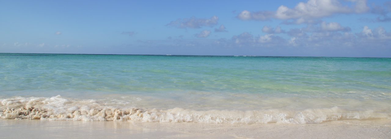
 ST. JOHN, US VIRGIN ISLANDS

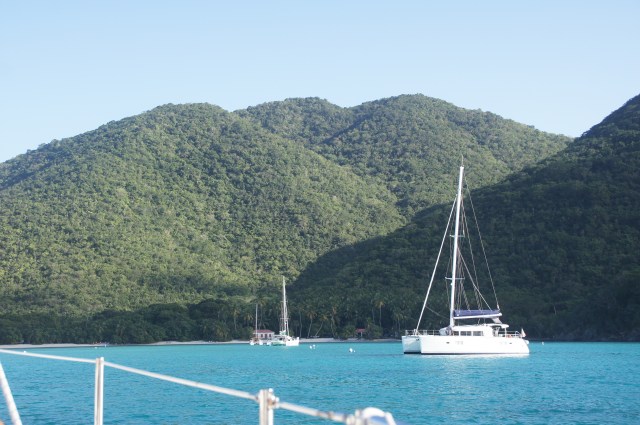
BRITISH VIRGIN ISLANDS
On the way to Guadeloupe, after racing through the BVI’s we made what we thought was one last overnight sail to Simpson Bay on Sint Maarten (the Dutch side). This is the only island in the Caribbean with 2 separate nationalities. There is the Dutch side and a French side, aka Saint Martin (prounounced “sa ma tah) separated by a small waterway and a couple of bridges. We anchored in the Western part of the island in a nice location near the city. We were able to take the dinghy under the bridge and get to other parts of the island or even the French side. The island is famous in this part of the world for the Heineken Cup sailboat race. This is a several class race takes place the first week of March. We were there to watch the boats out practicing and the town getting ready, but didn’t stay for the race, but we did have lunch at the Sint Maarten Yacht Club.

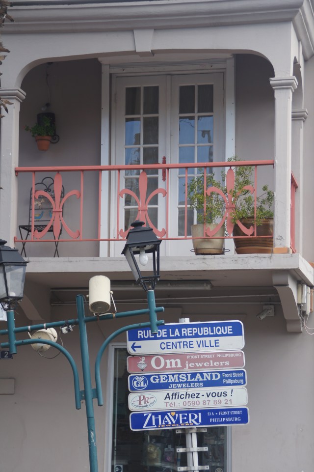
FRENCH SIDE OF ST. MARTIN!
Let There Be Light
There are 2 or 3 very well stocked marine stores on the island and we used this opportunity to purchase new LED bulbs for our light fixtures. Energy management is top priority on the sailboat. Since we are anchored out and not connected to power every night, we must rely on the battery bank for powering our lights, electronics, recharging phones, computers, and ipads. We spent a few nights early in the trip just turning on individual components just to see how much energy they require. We found the lights are the greatest drain on the battery. The solution was to switch from incandescent to LEDs. They are preciously expensive items anywhere, but they have literally revolutionized our nights. We are now sitting in light after sunset not worrying about the amps we are using with the incandescent bulbs. We can run several lights and only use 1-2 amps, where as before we were eating up 5-7 amps of battery storage at night. We have only 2 other electrical components running all night: the refrig/freezer and anchor light (which is LED already). We are able to store quite a bit of energy with the solar and wind generators, but without the LEDs we were using it up in a heartbeat. Oh one other great new addition to Lost Loon is a Lucy light. This is the neatest solar powered light. It inflates to the size of a small coffee can and will stay lit for 5-6 hours if fully charged during the day. We leave it on in the evening if we go to shore for the night and when on board take it from the cockpit to the dining table in the salon during the night ……and some nights don’t even burn one of those expensive LEDs!!
While on Sint Maarten we took time to relax. We have made tracks on this trip, lingering little and needed a few days to settle. We made a trip to some potential snorkeling grounds on the French side of the island, to find that the winds and waves were just too active to have clear water. We found a nice resort that had a great beach that overlooked the anchorage, and we spent a few afternoons swimming here.
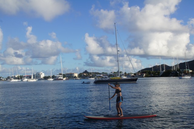
RELAXING IN SINT MAARTEN
We also took time to sail on some pretty wonderful waters. There is a volcanic island just 15 miles to the South of Sint Maarten called Saba. It stands off in the distant towering 3085 ft from sea level. Unfortunately, the waters around this island are very deep (however poor for snorkeling, but awesome for diving we hear) and anchoring in all but very calm conditions is impossible, so we decided to sail by the island, saving the overnight anchoring for another day.

SABA
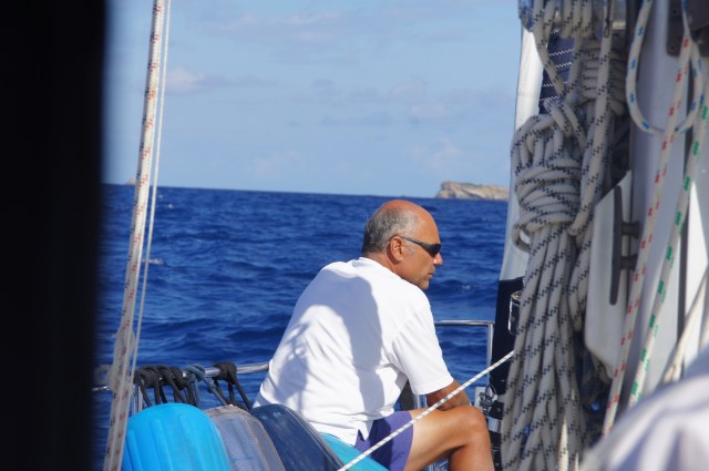
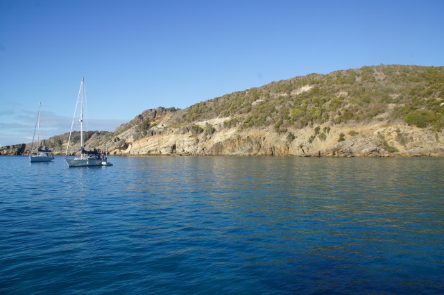
We headed out on a clear morning and had a perfect sail south, as we made a 10 mile approach we decided to head northeast to some islands just off St Barthelemy, Il Fourchue, known for snorkeling. We had lunch in a quite rolly and windy anchorage, but the clarity of the water was incredible. No beach here either, and the landscape was quite barren and dry. We had concerns about staying here for those reasons as well as knowledge of a cold front headed very far south, due to hit the following morning. It was predicted to bring heavy squalls with high winds moving from the East to the South, around to the West and then North. (this is called clocking..winds move like the hands of a clock and rarely do they make a 360 unless there is some pretty significant weather system). It poses a problem for boats on the ocean as well as those at anchor because unless very well protected in a good bay or lagoon one must prepare for a rough ride. It was a beautiful day, how could such a storm be on the horizon. We had not seen cold front weather since Luperon…several hundred miles to the east. We decided that we would return to Simpson bay and ride it our there if we had to. We sailed (no motor this day) for over 8 hours in perfect seas and moderate breeze. We returned to our previous location to anchor, setting out plenty of chain to hold us if we made the 360. We monitored the location of the other boats noting their proximity should we all begin to move, we figured we were well set. We even had time to head to our little beach spot for sunset, grab a few provisions, for we decided that we would return to St Barthelemy when the weather calmed the following day.
One o’clock in the morning, the winds picked up and we made our first move from the East to the South. The rains were moderate and seas had also picked up. As we got up to close hatches we watched lightening in the North, something we had not seen since the Bahamas. By 2 AM we were seeing sustained winds at 18-20 and intermittent rain showers. By 4:30 in the morning we had moved to facing the West, continuing to clock, and with the action of the wind and seas we felt as if we were in a washing machine. The sea state was confused, with winds that change direction at high speeds, waves seemed to be coming from all directions. We were awake in shifts, tired and also worried about the other boats out there losing their hold. We watched 3 other boats at a distance just motoring around as we assumed they had lost hold. They did not have a choice but to slowly motor at a safe distance until morning when the light made it safer and easier to put down an anchor. We spent the night in shifts again, not unlike the nights making passage between islands! By morning light boats were moving in all directions and we were very close to another sailboat. We continued to rock violently. However, once the rains subsided by 11AM we were pulling up the anchor and heading for St Barth’s. We figured the seas might be and were rough for a while, but we didn’t feel comfortable sitting at anchorage bobbing up and down, swinging side to side for another day.
GOVERNORS HARBOR
We were able to safely arrive in secluded Governors Harbor on the South side of St Barth’s on a windy but sunny Monday afternoon. We had arranged to meet up with our friends on Desderata, who had contacted us on the VHF indicating calm conditions. We were definitely in search of a quiet anchorage after a hectic night and did. We pulled into beautiful crystal clear blue waters where you could literally see the sand bottom at 25 ft. It was warm and flat and perfect for an afternoon swim. We were surrounded by mountains that dropped off into craggy clifts to the waters surface, only a few houses were visible in the daylight on the hillsides, but they were like Christmas lights by nightfall.

Next up…St Barthelemy, a true French island!


Amazing! So happy for you! >
LikeLiked by 1 person
Nanc, Once again you are taking us on your adventure-how lucky are we!! Just the thought of warm crystal Caribbean waters and winds somehow makes looking at frozen North Twin Lake more tolerable . Thanks again – soft breezes and calm seas;)
LikeLike
I always feel like a kid at Christmas when there’s a new post. You paint a word picture that is multidimensional; I can feel the wind, the tension of a rough nite at anchor, and the joyful ease of dropping anchor in a quiet, secluded spot with friends nearby. Thank you, Nancy, for sharing your adventure. It is a generous gift.
LikeLiked by 1 person